2022 Bitter Pill – Results
The Bitter Pill returned to familiar terrain for 2022, starting from Blush Hill Country Club in Waterbury on a crisp 49º morning.
Racers received maps at race start, one big overview map with a number of smaller focus areas. The first leg was mostly on Vermont roads and the navigation wasn’t too complex, so teams set out without needing much planning time, collecting a single checkpoint flag on a local bike path.
Whatever route teams chose, one thing was certain – reaching the first transition area meant a lot of uphill biking, a harbinger of the day ahead.
The next leg had checkpoints placed all around the Waterworks trail network, the source of Waterbury’s water supply. Unlike many GMARA legs with the word “water” in them, this wasn’t a swamp – but it was a maze of twisty passages, with official trails not always matching the reality on the ground.
Racers at TA1 had many options – they could leave their bikes in the large field of goldenrod and pick up points on foot, they could attempt to bike the trails (with permission from the town for our event), or a little of both. Teams even had the option of hitting the final two CPs as part of this section or on the way to TA 3. A few teams found all the points 2-9 and Bonus Point A during this leg, but all the teams found the navigation a challenge.
Thankfully, this did involve a bit more biking uphill. Wouldn’t want those tires to get cold.
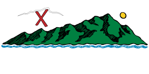
It was during this leg that racers had their first shot at CP Y, a non-standard “get it anytime today” checkpoint on the edge of the reservoir.
Many racers expressed appreciation that this was “pure orienteering”, no nasty web of trails to throw off your navigation. Volunteers staffing TA 3/4 enjoyed seeing that there was no clear consensus about the best way to start, and racers chose a variety of routes. If you’re curious to see more route details, check out the Strava Flyby. It’s fascinating! If you’ve uploaded your track to Strava and need help making it public so it adds to the tangle, please let us know.
As expected, everyone was super stoked to start another 1000′ of climbing. During the climb, there were 3 checkpoints to collect, the first at the site of a large landslide in 2019, which destroyed the shortcut trail from TA 4 to Little River State Park. The history of the region is quite interesting, as the Ricker Basin was once a thriving community in the 1800s. However, after the flood of 1927, the Civilian Conservation Corps constructed a dam and flooded the region creating what is now the Waterbury Reservoir.
There are still old stone walls, foundations, and chimneys remaining in the area, but racers may not have noticed as they enjoyed the well-crafted S curves and the downhill travel. 3 more checkpoints and another possible “get it when it feels right” CP X on a tiny peninsula on the reservoir, and racers arrived at TA 5.
At TA5, racers were psyched to drop off their bikes for the last time, and prepared to start their paddle… but unlike most years, the boats were on the dry side of the dam and teams would have to lug their boat up and over before they could get in the water.
Up, over, and into the reservoir they went.
One team even swam out to CP 26, a buoy close to shore.
Checkpoints 26-31 were waiting on the water, as well as another chance to pick up CP X — and CP Y if you wanted to add an extra 2 miles of paddling!
As can happen during adventure races, the challenge on the trek to the finish was less about navigation and more about land ownership and permissions, so racers were given a detailed map review before heading out. After 11 hours of racing, “Follow this exact route, but don’t be too exact about it” is guaranteed to make your head spin a bit.
Oh, and since they were heading back to Blush Hill, racers closed their day with another 600′ of elevation gain! Supposedly if you finish where you started, the amount of downhill should equal the amount of uphill. More than one team might now be questioning this logic after spending what felt like all day climbing.
Friends, family, and volunteers were waiting at the finish line. Almost every team was off the course by 5:30, undoubtedly looking forward to dinner and relaxation.
Two teams collected every point and continued to the post-paddle bonus section. Ultrabambi won the premier 3-person coed division picking up every primary point and one of those final bonus checkpoints in 11 hours and 39 minutes, while Strong Machine’s 2-man team picked up one point more than that and finished only 4 minutes later. Winning teams (and raffle winners) went home with some fabulous prizes from Mammut, the Outdoor Gear Exchange, and Cabot.
Check out the extensive details on the results page.
Thanks to all the sponsors, partners, volunteers, and racers for making this another great day in the woods. With so many GMARA regulars racing (in this race and overseas) it was a bit of a trick to pull this all together, and this year’s crew was phenomenal. If you’ve ever wanted to spend more time in the woods, take up photography, lift 110 bikes into a truck, chat with sponsors or talk landowners into letting a crowd run through their backyard – reach out and let us know!
Photos are up in the usual spot. If you’ve got photos, videos, blog posts, GPS tracks or stories from the trail, please send a note to staff@gmara.org with details and we’ll get them up here.
Bitter Pill 2019 Results
We packed everything you love into the Bitter Pill 2019:
- Epic downpours!
- Extreme bike repair!
- Family-friendly adventure!
- A downhill bike park where you only get to climb!
- A heinous swamp-whack!
- Cheerful competition between world-class teams!
- Trails that may not be on the map!
- Swimming & paddling upstream!
- Cabot cheddar!
We were feeling generous, so we let racers sleep in – at a leisurely 5:15 a.m. teams started biking downhill from Blush Hills Country Club.
With a hint of daylight, dirt roads led to a 300 ft hike-a-bike and a hop over Route 100 under the watchful eye of Altai the crossing guard dog.
Community paths took racers through the village of Waterbury to the fabulous Perry Hill bike trail network maintained by the Waterbury Area Trail Alliance.
Perry Hill is known for its downhill trails, expertly crafted for fun while descending.
Our teams had eight optional checkpoints to find, but unfortunately they were starting from the bottom and ending at the top.
Our course testers encouraged racers to take a few runs in the downhill direction to maximize enjoyment, but it is a race, after all — many teams opted for a “less fun, more speed” approach.
Other teams went for… less speed, more biking in circles? Hopefully they all had more fun as well.
After finding all the Perry Hill CPs (or tapping out after endless loops on unmapped trails) racers made their way to the top of the hill and headed toward the Middlesex notch, with special one-time permission from adventure-friendly landowners. For teams exhausted from non-stop climbing, the views at CP15 were beautiful. That joy was short-lived, however…
Shortly after CP17, teams were greeted by a control flag with an ominous message.
As our course tester said: “You can quote me, it’s a mandatory heinous swamp-whack.”
Many teams simply accepted their fate, dove in and carried their bikes through knee-deep (or worse) muck. Lucky teams persevered in their search for the old road/trail and were rewarded with dry travel… for a few hundred feet.
Thanks to the NH Trail Vets Development Squad, you can see a short video of some young racers getting a crash course in adventure racing. Maybe this is why we make you carry PFDs through the bike leg!
No matter what route they chose while collecting CP18 and 19, everyone seemed to agree that the Middlesex notch and its series of beaver ponds was beautiful, if a bit squishey.
Once they cleared the swamp, it was nothing but smooth biking on perfectly groomed trails until TA1.
No obstacles to climb over, brush to scramble under, or smooth wet rocks to slide off. None!
Wet, squeaky brakes signaled the arrival of each team as they approached the transition area.
The TA was located at the corner of the Middlesex town forest and the start of the public trail leading to the top of Chases Mountain. Racers paused to enjoy some Seriously Sharp Cheddar donated by the Cabot Creamery, and many took the opportunity to study their maps and “wash the swamp out of their socks” (metaphorically or literally) before heading out on foot.
In yet another display of magnanimous benevolence, GMARA let teams leave their bikes, helmets, and even PFDs behind while on the trek.
There were nine flags in the Middlesex town forest, five standard CPs and four worth bonus points due to their difficulty — including two that were relabeled after course testing! With a newly blazed trail heading directly to the summit, racers had to study their maps and decide whether to head to the top and attack from above, drop down into a ravine looking for waterfalls, or run headlong down old logging roads leading away from all checkpoints.
Endless reentrants, small streams, false summits and jeep trails challenged even the best navigators. Only three teams reached all CPs and BPs during this leg.
Aware of a rapidly approaching 3:15 pm paddle cutoff, teams returned to the TA to pick up their bikes and follow classic Vermont dirt roads to CP 27 and then TA3.
At TA3, racers were finally able to ditch their bikes for good. Some were treated to loaves of fresh bread thanks to a surprise day-of sponsorship from Red Hen Bakery, neighboring TA3. Rumor has it one team even stopped at the bakery for a quick lunch…
2-person teams grabbed tandem kayaks, 3-person teams hopped into canoes, and they all headed off in search of five more checkpoints and TA4.
Unexpected rapids and tricky navigation were not the only challenge. Incoming thunderstorms meant paddling into a headwind, and for a few teams heavy rain & hail. Again thanks to the NH Trail Vets: Maybe this is why we make you carry bike helmets during the paddle!
Upon reaching Little River, teams had a single point to grab on the west shore and then a short portage to TA 4.
Climbing the bank was a challenge even before the afternoon’s intense downpour, but everyone was excited to carry their boats once they pulled them uphill.
Given the distances traveled already, the short distance remaining didn’t look intimidating at a glance. Teams ran across little river and headed towards CP Y & Z.
Looks can be deceiving however, and the labyrinth of old snowmobiling & logging trails was a navigation puzzle as teams sought a route back to dinner at Blush Hill.
The few teams with extra time attempted BP C, the final bonus point. Instructions cautioned that it could take longer than expected, and when racers reached the location marked on their maps they were greeted with a message:
Sorry Mario
Your bonus point is in another castle
150 meters away on a 100º bearing
It might have been only 150 meters distant, but it was at least 75 meters uphill, with a slope steep enough to require travel on hands & knees. Good luck keeping a bearing on that climb!
Finally out of the woods, all teams returned to the finish at Blush Hill Country Club greeted by many eager cheering fans.
After that it was time for a fabulous post-race dinner from the Blush Hill catering crew!
Winners of each division took home some great prizes from Cabot, Ben & Jerry’s, OGE and Mammut. Strong Machine and GOALS ARA were the only two teams to clear the entire course including 33 primary points, 3 bonus points, and 2 reclassified extra-credit-due-to-unpleasantness points.
Strong Machine took first place overall, winning the 3-person male division with a total time of 9:54 on course. The premier coed division winners were GOALS ARA, taking home a $400 sponsorship to USARA Nationals from GMARA. Team Kash won the 2-person female division in 12:06 missing only BP B, while GOOSE A.R. won the 2-person male division missing only BP C and just a minute behind Team Kash. Power Source won the 2-person coed division, missing only two points from the full set. In a first-ever for GMARA, the five division winners were also the top 5 teams overall.
Check out all the in-depth details on the results page.
Thanks to all the sponsors, partners, volunteers, and racers for making this another great day in the woods. We couldn’t do it without your support!
A special thanks to spouses and kids who put up with adventure-planning craziness. They know that these events aren’t just a huge amount of work, they’re a huge amount of fun – like a family reunion — but a family with some really odd traditions.
Photos are up in the usual spot. If you’ve got photos, videos, blog posts, GPS tracks or stories from the trail, please send a note to shawn@gmara.org with details and we’ll get them up here.
Thanks for racing!
– The GMARA Crew
2019 Bitter Pill – Registration Open!
Registration is open for the Bitter Pill! August 10th near Waterbury VT: hike, bike, paddle, maybe a swim if you’re unlucky. Early registration pricing is the best deal – sign up by next Saturday (May 10th) to lock in the best rate. It’s likely we’ll have to cap entries based on the number of boats we can rent, so sign up early to avoid getting left out.
This year’s Bitter Pill is a qualifier for the USARA Nationals in Boone, North Carolina on September 26-28; the top 3-person coed team will win a $400 sponsorship to that event. We don’t know yet whether we’ll be able to offer a “Test Your Nettle” short event alongside the Bitter Pill, but we’re staring at maps and trying to make it happen. When those details get finalized, we’ll let you know.
Lastly, the gmara website has had a bit of a facelift – if you have any issues with the signup process or the site in general, please drop us an email. Our site (like our races) is built entirely by volunteers in their spare time.
Bitter Pill 2017 Results
The GMARA crew explored new terrain this summer!
New trails to run, waterfalls to find, ponds to swim and hills to climb… so many hills…
With Sugarbush hosting, we had the opportunity to use both Lincoln Peak and Mt. Ellen.

As a special bonus the crew at Mad River Glen was happy to have us run around Stark Mountain as well.
That’s right: three spectacular Vermont ski areas where racers could gain (and lose) elevation!
The 14th Bitter Pill started as many do, teams running uphill in the dark.
From the base of Mt. Ellen, racers had to reach 5 checkpoints on streams and trails. The woods were nearly impenetrable at times, but after 1600′ of climbing all the teams reached CP5 in a clearing on the ridge.
On the north side of the ridge:
Stark Mountain and the steep slopes of Mad River Glen!
From the clearing on the ridge it was decision time. Teams needed to reach at least 5 of the 8 CPs on Stark Mountain, with extras counting as bonus points.
For most, that meant a choice beween climbing another 600′ to CP6 on the top of Stark Mountain, or descending 1000′ to CP7. At least one team split the difference, and chose a route straight through the woods to CP8.
Nav decisions in this section were critical.
With so many waterfalls, streams, cliffs and rocks to visit, it was tough to be sure what the best route would be.
For a fascinating look at the choices, check out this Strava flyby.
After they experienced enough falling water, racers hit TA1 and transitioned to bikes, with a brief stop for Garuka Bars and locally sourced bacon from Home Plate in Waitsfield.

The first team to get all 8 points was out of the woods and on their bikes by 8:04am, a full 35 minutes ahead of the next team. Nearly 50% of teams were trekking for 5 hours or more.
From TA1 it was a quick 3-mile downhill on VT Route 17…
…and then a 700′ non-stop climb up Marble Hill road to CP14.
Some racers noticed the pig farm at the top of the hill, others were too focused on the delightful climb.
After Marble Hill, it was on to the third ski area of the day: Lincoln Peak!
The larger of the two Sugarbush sites, Lincoln is known for having awesome downhill bike trails. Take your bike up the lift, ride down some fabulous switchbacks, repeat.
GMARA racers weren’t allowed to use the lift, they had to bike 1700′ total up access roads and trails. Adventure!
Five checkpoints at Lincoln and then a truly rewarding downhill before returning to Mt. Ellen.
At the second transition area, racers dropped bikes and prepared to start the final trek.
Two mandatory points and three bonuses for those who still had time (and legs).

First though, they were told about a secret bonus point: swim out as a team & ring the cowbell in the nearby pond for a 30-minute bonus!
The pond at Mt. Ellen is fed by mountain streams and used for snowmaking in the winter. It’s appropriately chilly.
Nobody seemed to mind too much, once they remembered how to breathe!
The first team to clear the course finished at an amazing 1:37 in the afternoon. The rest of the teams joined them over the afternoon, with all teams accounted for by the 5:00 cutoff.
Full race results are posted for anyone who wants to compare details.

After that it was time for a fabulous post-race dinner from the Sugarbush catering crew, time to swap stories and get a massage from Abbie!
Top prizes went to the coed teams, with “Chaffing the Dream” taking first in the 3-person coed division (and completing their sweep of our events for the year). They took home a set of season passes courtesy of Sugarbush, a $400 sponsorship to USARA Nationals from GMARA, and some great gear from Mammut and OGE.
It’s rewarding to be awesome navigators who don’t mind 8600′ of elevation gain and 30+ miles in a day!
Untamed New England took second place overall and first in the 3-person male division, finishing only 25 minutes behind the leaders and also clearing every point on the course.
We also had our first-ever tie for first in the 2-person coed division, with both “A Paradox” and “The Rugged Rats” clearing all primary checkpoints with exactly 15 minutes to spare. All the details on the results page.
Thanks to all the sponsors, partners, volunteers, and racers for making this another great day in the woods. We wouldn’t do it without your support!
Photos are up in the usual spot, with some highlights in the Best-Of collection.
If you’ve got photos, videos, blog posts, GPS tracks or stories from the trail, please send a note to shawn@gmara.org with details and we’ll get them up here.
Thanks for racing!
– The GMARA Crew
Adventure 101: Stinging Nettles
If you hang around GMARA events you’re guaranteed to hear volunteers joking about nettles. Not sure what a nettle is? Time to “brush up” on your knowledge! (ha ha)
See those tiny white spines on that leaf?
Wikipedia says that nettles have “many hollow stinging hairs on the leaves and stems which act like hypodermic needles, injecting histamine and other chemicals that produce a stinging sensation.”
Delightful, right?
You’ll find patches in areas where the ground stays wet but the sun can peek through.
They almost always grow right in the middle of the route you’re trying to follow, too.
It’s worth knowing what to look for in case you’d like to avoid them, but nettles aren’t as worrisome as poison ivy or giant hogweed.
They’re more of a temporary irritation, much like a good adventure race.
Frigid Infliction 2017 Results
Skiing! Snowshoeing! Drifts so deep you need a shovel to find the checkpoints! But then we saw this:
Burlington, VT hit 72F today. This smashes the daily and all-time monthly records.
— NWS Burlington (@NWSBurlington) February 25, 2017
Ok, so our classic winter event won’t be typical this year, maybe it’ll be a warm-weather trail run.
The weather report for the next 5 days looks like this: 45, 32, 2, 30, 46.
Guess which day I'm gonna be racing in the woods for 10 hours.
— Brian Staveley (@BrianStaveley) March 2, 2017
Or, we could have a brutal single-day cold snap. The Frigid Infliction: Truth In Advertising!
With a forecasted high of 2 degrees and winds gusting to 40mph, it wouldn’t be a warm-weather anything… in fact, it would be the coldest Frigid since it started 12 years ago!
After much of the snow melted, Bolton warned us that the nordic trails were mostly solid ice or wet rocks – not particularly ideal for skiing.
When the temps dropped, those wet rocks turned to icy rocks. Much better!
It was not much better. We notified teams that skiing was unlikely and they could choose a microspike trail run instead.
Teams weren’t deterred by the lousy weather.
Lots of new racers accepted the challenge and some regulars showed up for their 11th, 12th, 13th, or even 15th GMARA event.
On Saturday morning, the pre-race briefing started at 6:15 (two hours later than most years). Racers were told that they’d need to spend more time strategizing this year, because there was no order to the points on the course.
Our plan was to require a minimum of 5 checkpoints on each discipline with teams choosing how to start (skis or snowshoes), where to go, which points to get, and how soon to switch from one set of gear to the other.
Without skis, that switch was less noticeable, but we did still enforce a gear transition between snowshoeing and postholing.
GMARA always tries to be polite and friendly, so we gave the racers some extra indoor time for map study. Then, we kicked them out into the cold for race start.
Temperatures were hovering around -8, but at least it wasn’t too windy. Yet.

We heard after the race that the different nav choices were one of the best parts of the event. Too often, teams at the Frigid end up following each other, making a snowshoe-trail conga line. We do what we can to break that up, but to some extent it’s unavoidable when there are required checkpoints in a certain order. On this course, almost every point had trails coming and going in multiple directions.
Oh good, there’s the snow and wind that we were all missing.
Racers that were hoping for a cold but clear morning quickly realized that better visibility was not in the cards.
For those whose strategy had the more difficult points early in the day, the timing of the storm would prove to be a major wrench in the works.
Here’s a shot of Bonus Point D, taken in happier times. This is “Stowe View” a lovely lookout at about 3100 feet. The checkpoint flag is straight ahead, though it’s not visible – it’s a few meters downhill behind some of that brush.
Now imagine that same view, but add icy snow gusting uphill from Stowe at 40mph, and you’ll see why even with great navigation skills some teams just couldn’t find BPD. We’d post a photo but (as one team said) it looked a lot like this.
It was so cold…
…that water bottles needed wool socks!
…that beards collected decorations!
…that multiple compasses froze!
So cold…
…that orienteering punches snapped in half!
…that eyelashes froze together!
Eventually, the wind let up a bit, the snow stopped blowing sideways, and racers started passing through the TA again to pick up or drop off snowshoes.
We suggested that teams pause inside the Nordic Center to look at maps in a heated space – and to make that more appealing, volunteers served up Garuka Bars and VT Smoke & Cure Bacon.
Never has the Bolton Nordic Center smelled more enticing.
While the Frigid racers fought to keep their toes and fingers from falling off, the first ever “Test Your Nettle” was starting back in the Nordic Center.
A new non-competitive event from GMARA, the Nettle was designed to let teams practice their navigation and adventure-racing skills without requiring an 8-12 hour commitment and a huge pile of expensive gear.
From new teams who had never used a compass in the wild to experienced racers introducing friends to the sport, they all received the same maps that Frigid Infliction racers were using, and similar instructions.
After a gear check and a short pre-race briefing, adventurers age 6 to 59 set out to tackle as much (or as little) of the course as they wanted.
Before too long, teams from both events began arriving at the finish — in surprisingly high spirits given the ridiculous weather, lack of skiing, numb extremities, and ridiculous weather.
Seems like adventure racers might just love a good adventure!
Once the course was cleared, everyone made their way to The Ponds for a great post-race dinner – including free Conehead IPA from Zero Gravity Brewing.
“Raise your hand if you can’t feel your toes!”
Actually, this was “Raise your hand if you still need a ticket for the prize raffle from our awesome sponsors!”
We had another amazing prize pool with high-end gear from Mammut USA, Ski Vermont, Burton, Skida, and OGE.

The best result of the day goes to the Mercators in the 2-person open division, clearing the entire course with two hours to spare, while the Raid International Gaspesie team won the 3-person open division. Full race results are posted for anyone who wants to compare details.

Along with new gear, racers always love the chance to race again. Thanks to our friends up north, we were able to give away a free race entry to the Raid International Gaspesie 3-day stage race in September (check out this teaser) and Strong Machine adventure racing also donated a 50% off entry to the Maine Summer AR in June.

We’re definitely expecting another GMARA team to race in Maine this summer and hopefully we’ll be able to send a U.S. team to the Raid as well – you should join us!
Another big thanks to the volunteers! We couldn’t do this without our support crew. If you’d like to volunteer, let us know, the position comes with a nice t-shirt twice a year.
Photos are up in the usual spot, please share!
If you’ve got photos, videos, blog posts, GPS tracks or stories from the trail, please send a note to shawn@gmara.org with details and we’ll get them up here. Here’s what we’ve got so far:
- Strava flyby with many different teams from both Frigid & Nettle.
- A race writeup from Chaos Raid and Directionally Challenged
- A writeup from Green Adrenaline
- A note from the Mercators on route choice.
A short story to close things out: While most teams were ready to sit in a hot tub or find a warm place to sleep after Saturday’s challenges, the Mercators hiked up to Bolton Lodge (not too far from the dinner location, unheated, with a door that wouldn’t close) and spent the night there in -10 degree weather. They woke up the next morning and gathered checkpoints from the course for us – 6,7,11,12,14,17, and BPA, all before lunchtime. Thanks, neighbors!

Watch your email for an invite – the Bitter Pill is coming on August 12th to Sugarbush.
Thanks for racing!
– The GMARA Crew
Adventure 101: What is a checkpoint?
Here’s one for the “things new racers may not know” category.
This is a checkpoint flag.
Sometimes you’ll hear them called “orienteering control points”.
We call them CPs, or BPs.
BPs = bonus points. Harder to find, same shape & color.
They’re bright orange and white triangle/square flags, sometimes with a blue stripe down the center to make them more visible for anyone who’s color blind.
We try to hang them so you can see them from a distance. Occasionally there’s a cliff face or tree in the way, but we don’t want you to have to look under every leaf pile to find the points.
This is the tag that hangs under the flag so you know whether you’ve found the spot you were looking for.
This is a punch, that hangs from the tag, under the flag… in a hole in the bottom of the sea.
Each punch has a unique pattern of pins.
And this is a passport. It’s made of tyvek, should be water-proof & tear-proof. When you reach a CP, you punch the appropriate box on the passport, and by comparing the patterns we know that you’ve found the point!
Just remember: you’re never lost when you’re at a checkpoint!
(Assuming, of course, that you still have a map.)
Adventure 101: Most paper isn’t waterproof
Here’s a quick illustrated tip, brought to you by a few unlucky Bitter Pill teams.
GMARA gets most of our race maps from MyTopo.
They’re printed on custom paper that’s fairly waterproof and tear-resistant – it’s pretty amazing stuff.
We encourage teams to keep the MyTopo maps in a specialized map bag because it’s still possible to destroy them, or more likely, to lose them in the woods.
For the most part they hold up well to adventure, including being folded repeatedly, spread out in the dirt, or left in the bottom of a boat.
In contrast, GMARA race instructions are usually laser-printed on normal 8.5×11 sheets of copy paper.
That paper isn’t waterproof.
Not even a little bit.
That wouldn’t be a problem if you never had to unseal your map bag, but in an adventure race, you sometimes need to make notes, draw on your map, or refold to see a new area.
All it takes is one drop of water to make some part of your instructions unreadable… or as seen here, completely destroyed – leaving you unsure where to go or what to do next.
That’s one reason we often see teams with more than one sealed bag – one racer has the instructions, one racer has the map.
Not only is it more likely to preserve the instructions, it’s also a good reminder to have more than one mind working on the navigation.
Lastly, if you put the map and instructions back-to-back in a single bag, you’re constantly flipping it over and trying to remember what you just read. Side by side is usually easier, especially as your brain gets tired.
Keep in mind, you don’t need to go out and buy high-end gear… a 1- or 2-gallon freezer bag will usually do the trick, although it won’t have easy attachment points for hanging around your neck.
One final tip: GMARA races based out of Vermont ski areas often make use of a resort trail map in addition to the topo map. For example, these from Bolton Valley. They’re usually printed on stronger stuff than our instructions, but they’re still not waterproof. Will you want a third dry bag, or is that overkill? How many freezer bags can one team manage before they feel like they’re actually racing through a kitchen? We’ll leave that debate to you.
New for 2017: Test Your Nettle
Have you always wanted to dip your toes into winter adventure without submerging your entire boot in a frozen stream? You're not alone!
New for 2017, GMARA presents Test Your Nettle, a chance to get your feet wet without fully diving in to an adventure race. It'll be shorter, cheaper, and require less gear than the Frigid Infliction – but it'll be on the same day with some course overlap. Teams from both events will gather at the post-race dinner so everyone can swap stories afterwards. Check out gmara.org/nettle/ for lots more information.
Originally, rates for the Frigid were scheduled to increase on Monday. Since we're throwing a new option in the mix, we're going to extend the early registration deadline for both races through next Wednesday the 11th. Talk to your friends, read the site, ask questions, and get signed up for the Frigid or the Test! Both events happen on March 4th, so you've got about eight weeks to warm up your compass needle, but sign up in the next 6 days to save a bundle!
We're thrilled to announce that lots of our regular sponsors will be helping out again with prizes and perks for 2017. Mammut, OGE, Garuka Bars, Ski VT, and Zero Gravity Brewing are on board again – and yes, that means free beer at the post-race party!
While you're training for the GMARA winter events, take a break to check out the Smuggs Ice Bash run by our friends at Petra Cliffs from January 20th-22nd and stop by the GMARA table at the BANFF Mountain Film Festival in Burlington Jan 26th-28th.
If you’ve got questions about testing your nettle or frigiding your infliction, leave a comment here and we’ll get back to you quickly. Two months until we all gather at the Bolton Valley nordic center – see you there!
OGE Bitter Pill 2016 – Results
GMARA has a theme for 2016: Doing more with less! This winter, the Frigid Infliction didn’t have enough snow to include a ski leg. For the Bitter Pill, we planned a nice long paddle, but forgot to gather enough water to make it fast & smooth.
Oh, and on race morning, only half the busses we ordered showed up.
Chris led the pre-race briefing under the 5:00 parking lot lights at Crossett Brook Middle School and then it was time to move!
Racers grabbed canoes and kayaks and started the day with a portage from the school to the Winooski river.
Luckily, with fresh muscles all of the boats felt like ultra-light carbon fiber racing models.
Two CPs during the first ~7k of paddling, and then racers approached the Bolton Dam.
CP3 was on the upriver side of the dam and marked the start of one of the more grueling parts of the day.
The portage was only 1k, but the hill was steep, and as the sun came up the lightweight racing boats revealed themselves to be more typical awkward 85-pound rentals.
Next time we’ll arrange a canoe-rappel straight over the dam.
After the portage teams were back in boats. Total paddle distance this year was ~21k.
Some teams added water to their boats for ballast, others found time for a refreshing swim.
Some practiced for riverdance by hopping in and out of their boat repeatedly.
CP4 was on an “island” if you consider three inches of water to be a “river”.
All these photos are available in the GMARA Photo Collection if you’re looking to get your favorite printed on a mug.
Download/share/print as much as you like, just give GMARA a shout-out!
Teams had a decision to make when attacking CP6 on the long trail footbridge.
The first eight teams all chose different routes. Some fought through brush and took the stairs, others climbed the steep treacherous rock face. Many tried to make it up the gently sloping rock on the western side, only to discover that it was more of a waterslide.
The fastest method we saw? Drop a teammate on the road upriver where it was an easy climb, let him run to the flag, and pick him up on the far side.
At TA1, racers lugged their boats out of the water one last time, grabbed their bikes, and said goodbye to the relatively flat Winooski River.
It was time to gain some elevation, somewhere around 2300 feet of biking uphill. Hope everyone enjoyed their low gear!
A special shout-out to the long-time racers who let us hang CP7 in their driveway.
We debated dropping the checkpoint in the pond behind their house, but after some discussion about leeches and wet bike shorts, we decided that wouldn’t be polite.
I guess we’re getting soft?
Racers dropped their bikes and paddling gear, then paused for bacon from VT Smoke & Cure and bites of Garuka Bars, two of our favorite sponsors.
The trek this year was one of our most challenging ones navigationally. There wasn’t a clear “best order” to gather the points, and they all required solid orienteering skills. The final checkpoint tally was surprisingly well-balanced, with each CP getting punched by at least 20% of teams, but very few teams reaching all the points.
You can view the detailed results yourself if you want to compare stats.
Teams returned from the trek in good spirits despite the tough nav.
We’d love to see the routes you followed! Here are a couple samples:
Rugged Road
North Is Everywhere
After the trek, racers passed through TA3 again, many stopping for more bacon and Garuka Bars.
Once they had gathered biking and paddling gear, it was one last uphill climb to the finish. There were two CPs on trails, though many teams chose to grab the first and then take the road to the finish.
It’s great to see you all smiling after you paddled at least 20k, biked at least 20k, and hiked… well… 10k or more, depending on how many times you circled each point, and whether you consider the river a hike. Based on GPS tracks, a few teams had a 60k day!
Division leaders this summer were Rugged Road, Chafing The Dream, Out of Control, Raid International Gaspésie, and Twisted Sisters, and the cookies went to “Bitter? We hardly know ‘er!”
Thanks to The Outdoor Gear Exchange, Mammut, Ski Vermont, VT Peanut Butter and all our other sponsors for a spectacular prize pool!
Thanks to the racers as well for showing your appreciation before, during, and after the race. Our little nonprofit exists because we love to get a crowd of amazing people lost in the woods, and we wouldn’t keep doing it if you didn’t love it.
Have photos or a writeup of your own? Please send them along and we’ll get them added to the collection!
We’ll be back again next year – get in touch if you want to help make Frigid 2017 happen!


